Cape Arago Lighthouse
Coos Bay, Oregon


Updated in September 2012
Name: Cape Arago Lighthouse / Cape Gregory Lighthouse
Nearest City: Coos Bay, Oregon
Location: Southwest of entrance to Coos Bay
Body of water: Coos Bay & Pacific Ocean
Style of lighthouse: Integral
Lens & Location: VRB-25 solar powered optic
Other Lens: 4th Order Fresnel Lens at the US Coast Guard North Bend Station
Organizations: Oregon Chapter of the United States Lighthouse Society
Groups to join: United States Lighthouse Society
Owned by: United States Coast Guard
Managed by:
National Register of Historic Places: Since 1993
Do the grounds have lodging: No
Web Cams: No
On a license plate: No
On a USPS Stamp: No
Haunted: No
Photographed it: June 15-16, 2002 / June 6, 2006
Purchase lighthouse prints from this page
Latitude: 43.34123 Longitude: -124.37543
For directions click Google Maps
Nearest City: Coos Bay, Oregon
Location: Southwest of entrance to Coos Bay
Body of water: Coos Bay & Pacific Ocean
Style of lighthouse: Integral
Lens & Location: VRB-25 solar powered optic
Other Lens: 4th Order Fresnel Lens at the US Coast Guard North Bend Station
Organizations: Oregon Chapter of the United States Lighthouse Society
Groups to join: United States Lighthouse Society
Owned by: United States Coast Guard
Managed by:
National Register of Historic Places: Since 1993
Do the grounds have lodging: No
Web Cams: No
On a license plate: No
On a USPS Stamp: No
Haunted: No
Other Lighthouse Information:
The Cape Arago lighthouse is visible from the Oregon Coast Trail between Sunset Bay State Park and Shore Acres State Park, and from Bastendorff Beach County Park. An overlook a quarter of a mile south of the Sunset Bay campground entrance offers a good view. There is a high bridge that links the mainland to the island but it is closed off to the public with a fence. In 1993 the Fresnel lens was replaced with a modern lens. The lighthouse was deactivated as an aid to navigation on January 1, 2006. Everyone hopes that the Confederated tribes of Coos, Lower Umpqua, & Siuslaw Indians or the government will one day reactivate the lighthouse and make it accessible to the public.The Lighthouse Hunters Experience:
In 2002 we parked the car on Cape Arago Highway, then walked on Lighthouse Way to get to the path we found to the water. It was a very short but steep, narrow, dirt, weedy path down to the water. We held on to the anchored rope while we inched down backwards to the beach. We walked on the beach just a bit to get a little closer to the lighthouse. After we took a few pictures we headed back up the hill. It was difficult to pull yourself back up this steep beachy cliff. We couldn't find this path again in 2006. This time in the afternoon we hiked ½ hour from Sunset Bay Beaches over a root and tree trail to the overlook cliff and took our shots.Photographed it: June 15-16, 2002 / June 6, 2006
Purchase lighthouse prints from this page
Latitude: 43.34123 Longitude: -124.37543
For directions click Google Maps
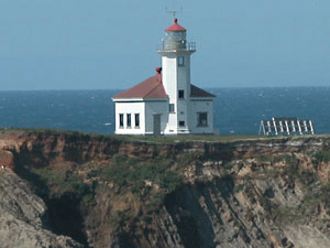
Photo taken on June 6, 2006
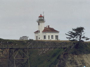
Photo taken on June 16, 2002
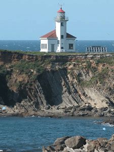
Photo taken on June 6, 2006
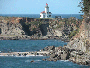
Photo taken on June 6, 2006
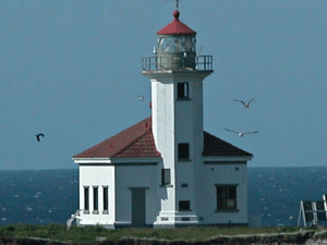
Photo taken on June 6, 2006
All photos contained in this site, © Copyright 1997-
by The Lighthouse Hunters - Christine & Tom Cardaci.
Images and text may not be used from this website without written permission. Contact Us for more information.
Images and text may not be used from this website without written permission. Contact Us for more information.


